
ECMWF has started assimilating data from wind-powered ocean drones, called saildrones, that have the potential to improve Earth system observation coverage in remote areas. Despite the rapid growth of satellite observations, in-situ data remain vital to numerical weather prediction. Direct measurements of key atmospheric parameters often provide useful adjustments to the analysis in sensitive areas. The impact of such observations is larger in less-observed regions. An article in the spring 2019 issue of the ECMWF Newsletter described the successful launch of 32 drifting buoys with pressure sensors in the northeast Pacific. Saildrone technology is another emerging platform well positioned to improve the coverage in remote areas and to perform targeted observation campaigns in regions of interest.

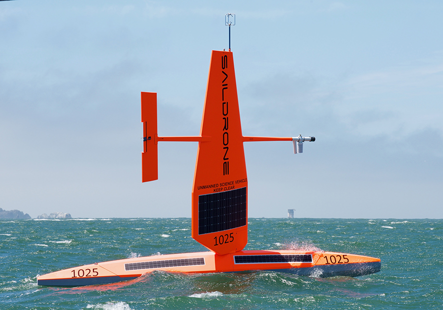
The saildrones operated by Saildrone, Inc. are unmanned, autonomous long-range observing platforms powered by wind and solar energy and equipped with a wide range of sensors measuring meteorological, oceanic and environmental parameters (for more details about the Saildrone technology, see https://www.saildrone.com/technology). Saildrones can survive severe meteorological conditions, allowing continuous all-weather reporting over extended periods of time. Over the past few years, Saildrone has successfully conducted missions to remote areas such as Antarctica. The future planned expansion of the network could reduce forecast errors in remote regions if the data are made available in near-real time.
In collaboration with the National Data Buoy Center (NDBC, US), Saildrone has started encoding and distributing data using the World Meteorological Organization (WMO) buoy reporting code form. Since 2017 a subset of the data has been made available in the WMO Global Telecommunication System (GTS) in near-real time. ECMWF has successfully received and assimilated the saildrone reports shown in the figure. The data are treated as drifting buoy data and, therefore, the same observation errors are applied and only surface pressure is used. No quality issues have been identified. Two methods are used to estimate the impact of observations: data denial experiments (running the model without the data in question) and Forecast Sensitivity Observation Impact (FSOI) diagnostics operated by ECMWF. Data denial experiments are not appropriate given the small number of observations (it is difficult for a handful of observations to make statistically significant changes affecting the large scale). FSOI diagnostics indicate a generally positive impact of saildrone data, although their collective impact is small because of the small number of reports. That said, drifting buoys and saildrone data might have a decisive role if they are near active systems where other direct measurements are absent.
Currently only a subset of saildrone data is made available to the community in near-real time. The expected evolution of the network will help fill the gaps of in-situ data availability in remote oceanic areas from which forecast errors grow fast to affect downstream areas. The encoding of saildrone data using the buoy template was a sensible choice to quickly make the data available to users, but in the long term it would be good to have a WMO template dedicated to saildrone data. This will make the quality control, data usage, monitoring and impact assessment easier. Currently the only saildrone data used at ECMWF is for surface pressure. In the future other atmospheric and oceanic parameters might be exploited for ocean assimilation and/or verification purposes.