A new collaboration between ECMWF and ESA will explore the potential of Soil Moisture and Ocean Salinity (SMOS) satellite data to support fire danger and flood forecasts. The 18‑month project will start on 1 December 2018.
SMOS use in weather prediction
SMOS is the second Earth Explorer Opportunity mission developed as part of the European Space Agency (ESA) Living Planet programme. SMOS was launched on 2 November 2009 and provides two-dimensional interferometric radiometer measurements of L-band (1.4 GHz) brightness temperature from a satellite in polar orbit. At this frequency, the atmosphere is almost transparent, and surface emission is strongly related to soil moisture over continental surfaces and salinity over oceans.
The SMOS mission was launched to improve our understanding of the global water cycle and to contribute to advances in weather and seasonal/climate prediction. ECMWF has played a major role in achieving those goals by developing methods to integrate SMOS brightness temperature into numerical weather prediction (NWP) models, with a focus on land-surface processes.
New uses for SMOS data?
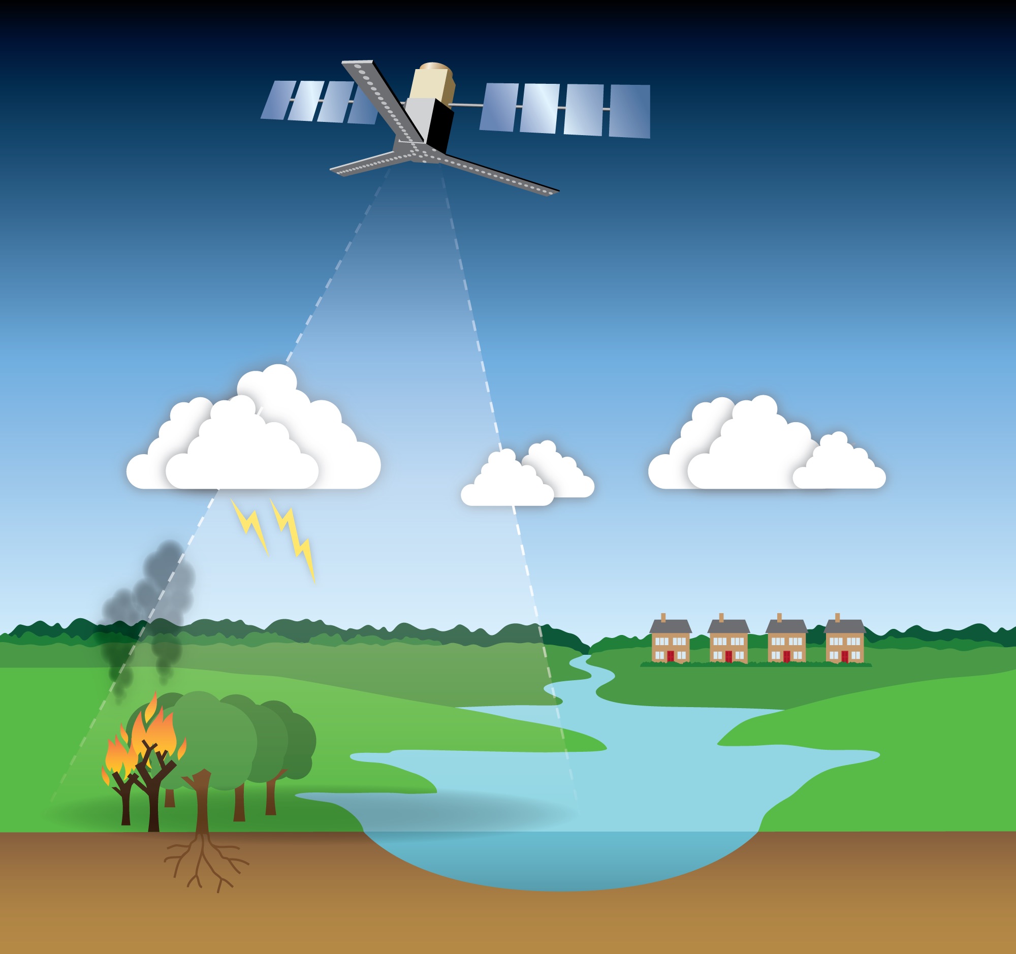
Beyond the direct use in NWP, a number of scientific studies have shown the potential benefit of integrating SMOS observations into other applications. Since ECMWF contributes to the Copernicus Emergency Management Service as the computational centre for fire danger and flood forecasts, it is in a unique position to evaluate the potential of SMOS data to support applications in these areas.
SMOS data could, for example, help to estimate fuel moisture and thus the amount of biomass available for burning. In addition, soil moisture information could be combined with lightning forecasts to estimate the probability of ignition from lightning. Understanding the influence of fuel moisture on fire emissions could also lead to better predictions of air quality in downwind areas.
Soil moisture is also a key driver of flood risk, with saturated soils increasing susceptibility. River flow forecasts depend on an accurate estimate of initial soil moisture. SMOS data could improve the accuracy of such estimates as used by the European and Global Flood Awareness Systems (EFAS and GloFAS, respectively). Finally, SMOS data could be used to create a new standalone product to highlight areas susceptible to flooding.