
ECMWF’s Annual Seminar on ‘Earth system modelling for seamless prediction’ opened on 5 September.
One of the speakers at the four-day event, ECMWF scientist Gianpaolo Balsamo, explains how improved Earth system modelling can lead to better weather forecasts.
Dr Balsamo’s interest in the interactions between the atmosphere and other components of the Earth system goes right back to his years as a physics student in the nineties in the Italian city of Turin.
His dissertation looked into how to take into account soil moisture when initialising meteorological models. “We showed that soil moisture spatial variability and patterns can help trigger high-intensity precipitation,” he recounts.
Keen to apply his findings in an operational environment, Dr Balsamo became a weather forecaster and land modeller in the Italian region of Piedmont, which is “prone to extreme weather and flooding”.
He loves that region, but his passion for research soon prompted him to pursue an international career as an Earth system scientist in France, Canada and the UK. In 2006, he joined ECMWF, where he now heads the Coupled Processes team in the Earth System Modelling Section.
Vital benefits
Dr Balsamo points out that the theme of this year’s Annual Seminar, an educational event attended by some 70 mainly early-career scientists from around the world, reflects the emphasis on progress in Earth system modelling in ECMWF’s new ten-year Strategy.

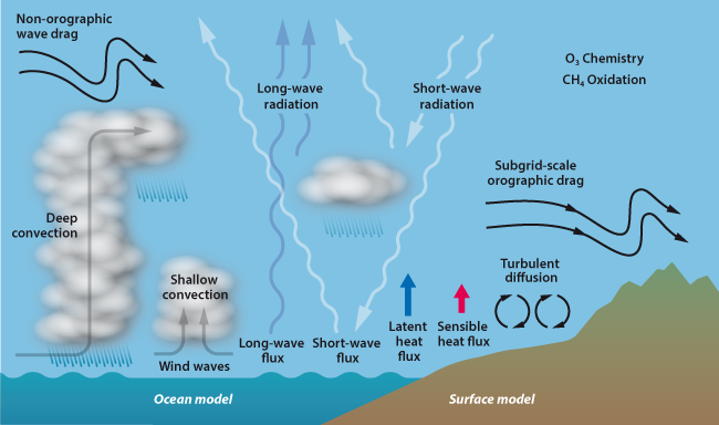
The state of the atmosphere is influenced by its interactions with its boundaries.
“It is well recognised that, in order to make further advances in numerical weather prediction (NWP), we have to better take into account the interactions between different components of the Earth system,” he observes.
But he adds that the devil lies in the detail: which processes need to be better represented, and at what level of complexity?
The atmosphere, the continental land surface including lakes, the oceans including ocean waves, and sea ice are all Earth system components which interact with each other.
As Dr Balsamo will point out in his talk, modelling these interactions is not just essential to improve weather forecasts but can also help to predict ocean and land parameters. Such Earth system forecasts can in turn feed into environmental information services, such as flood forecasts.
He will add, however, that getting the modelling right is not sufficient for good forecasts. Observations, both in situ and from satellites, are critical to help estimate the state of the Earth system at the start of a model run and to support model assessment.
Dynamic land surface
The representation of vegetation in the land model used at ECMWF is an example where progress in modelling has recently been made, and more is under way.

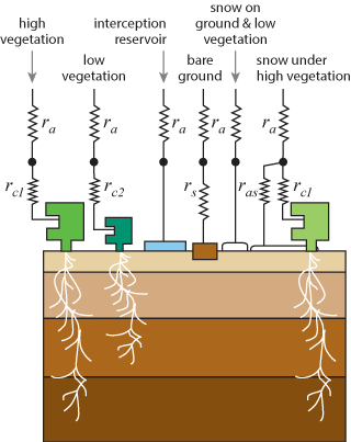
Land surface models for NWP distinguish between different types of vegetation and land cover, which interact differently with the atmosphere.
Perhaps surprisingly, in ECMWF’s early land models the state of vegetation was assumed to be static. The land model thus disregarded for example seasonal variations in many parts of the globe.
An improvement was introduced in 2011, when the representation of vegetation was made to vary from month to month in accordance with a climatology based on satellite observations.
However, the state of vegetation in, say, September, can also vary significantly from one year to the next in some locations. A more dynamic, monthly representation of vegetation is therefore one of the changes soon to be implemented at ECMWF.
“How well resolved in space and time we need to make the model is an open question,” says Dr Balsamo.
“In some circumstances, such as large wildfires, the state of vegetation in a particular region can change significantly from week to week and even day to day,” he points out.
Disappearing lakes
A similar issue arises with the representation of lakes: an Earth system approach to numerical weather prediction needs to include their interactions with the atmosphere, but at what level of detail in space and time?
ECMWF recently introduced a lake model which has improved forecast skill in the vicinity of lakes.
It does so by modelling the evaporation and heat fluxes between the lakes and the atmosphere.
“One study we conducted with Finnish colleagues showed that the amount of heat a forest transmitted to the atmosphere at midday in summer was up to 200 watts per square metre, compared to almost zero for a nearby lake,” Dr Balsamo says.
But the current lake model is static: it does not account for lakes forming, temporarily drying out, or disappearing altogether.

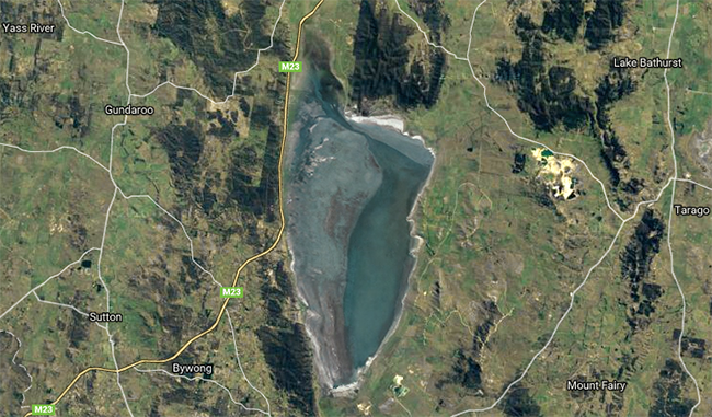
Some lakes, such as Lake George in southeast Australia, are shallow and can dry out for extended periods of time. (Map data ©Google Imagery ©2016 TerraMetrics)
“There are some lakes in Australia, for example, which are only there for six months a year, but they are there all the time in our model,” Dr Balsamo says.
Once again, the question is to what extent the lake model can and should be made more dynamic.
Multiple challenges
The challenges for land modellers do not end there. For example, how should the built-up environment of the world’s cities be represented in models, at what spatial and temporal scales?
And how should snow on the ground be represented?
Snow-covered ground is currently modelled as a single layer of snow above four different layers of soil to a depth of three metres.
But this does not take into account the different physical properties snow can have. An improved model tested at ECMWF includes no fewer than five layers of snow and nine layers of soil to better represent the thermal and water diffusion across the snow–soil medium.
Although his specialism is land modelling, Dr Balsamo stresses the importance of interactions between the atmosphere, the oceans, waves and sea ice to weather prediction at all timescales.
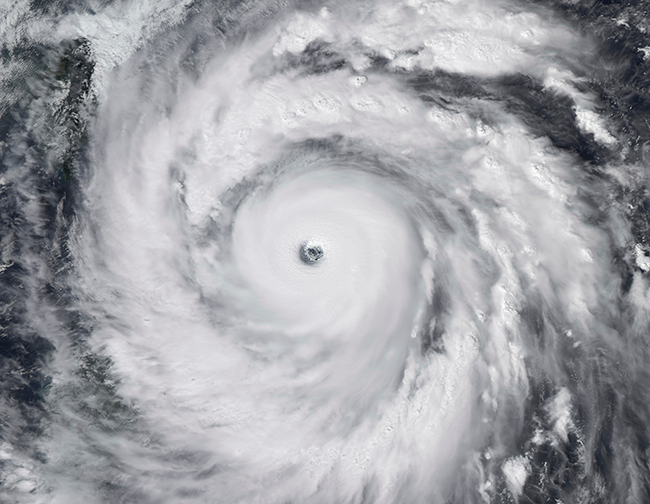
He gives the example of tropical cyclones, whose development is influenced by such interactions.

The upwelling of relatively cold ocean water at the centre of a tropical cyclone may weaken it. If this effect fails to be taken into account, atmospheric models can overpredict the strength of tropical cyclones. (Stocktrek Images/Thinkstock)
Challenges in the area of ocean modelling include the representation of coastal areas, which can have complex boundaries between the ocean and the land.
“What we have to aim for is a gradual evolution of the forecasting system in which model developments in all areas go hand in hand with efforts to increase the spatial resolution of the forecasting system, making greater use of satellite Earth observations,” Dr Balsamo says.
It looks like he will have his work cut out for some time to come.
