ECMWF forecast data for hurricane Sandy is available for free download for research use via the TIGGE archive. The TIGGE archive contains ensemble forecast data from nine global models. The ensemble data will enable researchers to explore predictability aspects, including the subtleties of the interaction between Sandy and the extra-tropical flow.
TIGGE, the THORPEX Interactive Grand Global Ensemble, is a key component of THORPEX: a World Weather Research Programme to accelerate the improvements in the accuracy of 1-day to 2 week high-impact weather forecasts for the benefit of humanity. The TIGGE archive consists of ensemble forecast data from ten global NWP centres, starting from October 2006, which has been made available for scientific research. TIGGE has become a focal point for a range of research projects, including research on ensemble forecasting, predictability and the development of products to improve the prediction of severe weather.
Hurricane Sandy made landfall in New Jersey on 30 October 2012, leaving a trail of devastation widespread damage both in the Caribbean and in the eastern United States. ECMWF forecasts provided valuable guidance on Sandy’s future track throughout its lifetime and were widely reported in the media. From the time Sandy was forming in the Caribbean on 22 October, the ECMWF ensemble (ENS) gave early indications for the potential to affect the north-east United States. From 23 October onwards the high-resolution (HRES) forecast consistently predicted landfall in north-east USA. This evolution was supported by the ENS, with few members showing the more typical scenario of Sandy staying out to sea and turning eastwards into the Atlantic.
Sandy was an extreme meteorological event, with major human impact over a wide area. The evolution of Sandy was unusual; the interaction with a cold-air system moving eastwards across North America led to Sandy turning westwards and making landfall in New Jersey. Researchers interested in studying the dynamics, forecasting and predictability aspects of Sandy are invited to explore the forecast data from ECMWF, NCEP and other centres available through the TIGGE archive at:
This data is freely available to download for research users. The archive includes data from the ECMWF high-resolution forecast (HRES, labelled “deterministic” in the TIGGE archive) and the ENS (control forecast and 50 perturbed ensemble members). Note that in the TIGGE archive the HRES is interpolated to the same horizontal resolution (approx 32 km grid) as the ENS.
ECMWF is considering the possibility to create and make available additional comprehensive data sets for the Sandy period, to include HRES data at full resolution and specific diagnostics. We therefore invite expressions of interest to Erik Andersson (Head of Meteorological Division) via e-mail to Karen.Clarke@ecmwf.int, indicating your requirements.
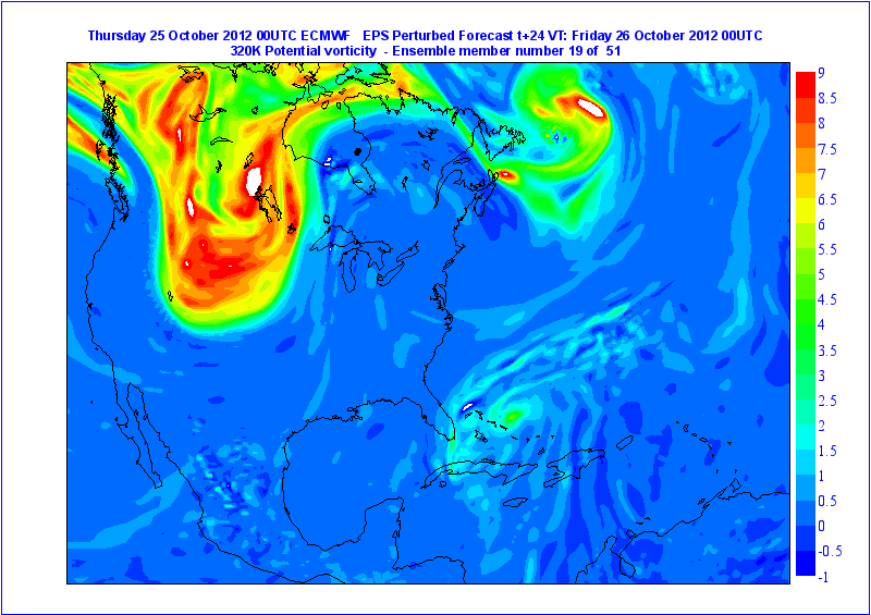
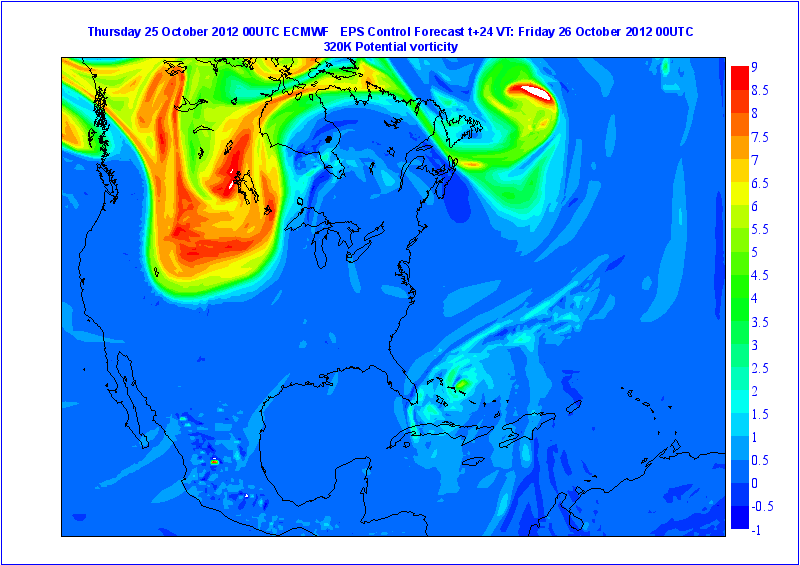
The animations below provide an example of the ENS data available from the TIGGE archive: PV on 320K surface. This shows importance of the interaction between Sandy and the upper trough over the USA: this system “captured” Sandy in the majority of the ENS members, while in just a few members Sandy “escaped” (as seen for example in member 19).