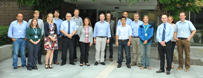

The Second User Consultation Meeting (UCM-2): Assessment of Final Products was hosted by ECMWF on 17 September 2014.
Description
GlobAlbedo is an ESA project that uses satellite data to map changes in Earth’s reflectivity. Knowledge of albedo is of critical importance to land surface monitoring and modelling, particularly with regard to consideration of climate and the biosphere. When albedo is used in models, it has often been specified as a fixed number for some given land cover type. However, many years of monitoring have shown that it can vary significantly both spatially and temporally.
The GlobAlbedo project has processed data from the Envisat and Spot-Vegetation satellites to produce global surface albedo maps from 1998 to 2011 using optimal estimation where a ten year climatology from MODIS had been used as a background field. The validated data and maps, available for free online, provide an accurate measure of Earth’s reflectivity. By combining data from different satellite sensors, scientists have maximised the coverage and created a time series that can be extended to include historical as well as future satellite measurements.
Objective of the meeting
The main objective of this meeting is the assessment of the final GlobAlbedo products through presentations and discussions between the producers and potential users of GlobAlbedo, about data quality and requirements as well as actual and possible applications.
Programme
Presentations
|
Introduction to the ESA-GlobAlbedo Project Tom Kennedy (UCL-MSSL) |
- |
|
GlobAlbedo data processing, products and validation Jan-Peter Muller (UCL-MSSL) |
|
|
Assessment of the potential of GlobAlbedo for climate model applications - examples using MPI-ESM Alex Loew (MPI) |
|
|
Assessment of the impact of GlobAlbedo data on the UK Hadley Climate Centre JULES land surface model Tristan Quaife (Reading NCEO) |
- |
|
Radiative forcing due to land use changes from GlobAlbedo product Gunnar Myhre (CICERO) |
|
|
Impact of land management on surface albedo over North America Micah Wilhelm (ETHZ) |
- |
|
Consistent EO Land Surface Products including Uncertain Estimates through the Two-Stream Inversion Package (TIP) Bernard Pinty (JRC) / Mat Disney (UCL Geography) |
|
|
Application of remote sensing data in global evapotranspiration (ET) estimate Xuelong Chen (ITC/University of Twente) |
|
|
GlobAlbedo impacts on the Met Office global model Malcolm Brooks (Met Office) |
- |
|
Impact of GEOV1 NRT and albedo on NWP within the ECMWF system Souhail Boussetta (ECMWF) |
|
|
Copernicus Global Land Albedo product: status and evolution Roselyne Lacaze (HYGEOS) |
- |
|
EU-FP7 QA4ECV: a 35 year ECV of albedos, fapar & LAI and their uncertainties Jan-Peter Muller (UCL-MSSL) |
Contacts
| ESA-GlobAlbedo | Jan-Peter Muller | j.muller@ucl.ac.uk |
| ECMWF | Chantal Dunikowski | chantal.dunikowski@ecmwf.int |

