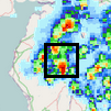
ECMWF has developed a probabilistic point-rainfall product which could support the prediction of flash floods across the globe. The product, which is based on an innovative post-processing method, aims to bridge the gap between the relatively coarse resolution of today’s global forecasting models and the higher-resolution limited-area models needed to describe localised heavy rainfall. The methodology is based on physically relevant statistical relationships between the larger-scale weather features well represented by ECMWF forecasts and local realisations represented by point observations. These relationships make it possible to compute statistically based (rather than raw-ensemble-based) probabilities for point rainfall. This includes extremes, which can be used to infer the likelihood of flash floods for use on platforms such as the European and Global Flood Awareness Systems.
The post-processing method blends together information from different locations whenever they experience similar rainfall generation mechanisms, assuming that these physical mechanisms are universal and dependent on key atmospheric and geographic properties. This means that:
- one year of global rainfall observations is adequate because it can equate to hundreds of years used in locally-calibrated techniques, and
- extremes can be successfully predicted even when they do not exist in a local record.
Moreover, the reliance on physics means that forecasts can be confidently produced for anywhere in the world, even places without observations. The post-processing system has been fully automated and requires minimal computing resources to run compared to high-resolution numerical models.

Methodology
Radar-derived totals show that very different geometries of rainfall total variability can arise within regions of a global model grid box of typical size. Global models include standard output parameters such as convective precipitation fraction, mid-tropospheric wind speed, convective available potential energy (CAPE), total daily clear-sky solar radiation and total precipitation that, on the basis of physical reasoning, make it possible to anticipate sub-grid variability and account for biases in grid-scale rainfall. Those parameters are used to define subsets, hereafter called ‘weather types’, which share the same meteorological/geographical conditions.
The amount by which observed rainfall totals at a point differ from short-range forecasts for the equivalent model gridbox can be expressed as a ratio, hereafter called Forecast Error Ratio (FER). By compositing many cases a general frequency distribution can be derived, which can be used to transform ensemble gridbox rainfall forecasts into probabilistic point-rainfall forecasts. The true utility of the new approach, however, lies in creating and using separate frequency distributions for weather types that differ from one another in significant and physically realistic ways, as illustrated by the small panels in the FER frequency distribution figure.
Outputs and example forecasts
The current pre-operational version produces probabilistic rainfall forecasts for points, in the form of percentiles from 1 to 99, once a day (00 UTC run), up to day 5, for 06–18 and 18–06 UTC validity times. The operational version (available soon via ecCharts) will produce forecasts twice a day (00 and 12 UTC), up to day 10, for 6-, 12- and 24-hour accumulations.
The output can be used by forecasters in different ways. For example, a user may be interested in identifying the wettest places in the world in two days’ time in order to anticipate which areas are vulnerable to flash floods. They could plot point rainfall (e.g. in mm/12h) for high percentiles, e.g. the 95th or 98th percentile, and could then say that there is 1/20 or 1/50 chance for the amount displayed to occur at a given location in a given grid box, albeit without being able to pinpoint exact locations within a grid box where extremes are most likely.
For instance, between 2 and 4 a.m. on 10 September 2017 more than 200 mm of rain fell in the vicinity of Livorno in Italy, causing widespread flooding and six fatalities. On the 98th percentile point-rainfall map for that night from two days earlier, parts of northern Italy, including Livorno, stand out as being especially vulnerable to very high totals. On the equivalent raw ensemble plot (not shown) this region does not stand out. On the basis of the point-rainfall forecast, one could have put parts of northern Italy on alert, albeit at a low risk level. Other considerations related to vulnerability (e.g. population density, topographic slopes, land use, soil moisture, flood defences) could have facilitated refinement of warning areas.
Where there is local knowledge regarding flash flood trigger levels, users may alternatively be interested in the probability of exceeding a certain threshold, as shown in the UK case study charts. This example also shows how the post-processing does not simply amount to amplifying signals of more extreme events.
Verification
A retrospective global verification for the current pre-operational system covers the period April 2016 to March 2017, for several sets of lead times (days 1, 3, 5), focusing on the reliability and resolution of the forecast (‘resolution’ here refers to how well the system is able to distinguish between occasions when events are more/less likely to occur).
Evaluation of the raw ensemble (ENS) shows an under-representation of small and large values. A much flatter rank histogram for the point-rainfall product is indicative of a much more reliable forecast. Finally, using the ROC area metric, the point-rainfall product exhibits greatly improved resolution. This is notably the case for higher thresholds, where the point-rainfall product at day 5 is about as good as the raw ensemble at day 1, illustrating clear added value for users.

