Amid the coronavirus pandemic, there is widespread interest in up‑to‑date information about how the resulting lockdown is affecting air quality, but also how the climate and atmospheric composition might impact the spread of the virus. The Copernicus Climate Change Service (C3S) and Copernicus Atmosphere Monitoring Service (CAMS) – both implemented by ECMWF on behalf of the European Commission – are helping researchers, policymakers and citizens alike with quality-assured data and tools.
CAMS and COVID
CAMS is focusing on the relationship between exposure to air pollution and the development of the COVID-19 disease in populations exposed to the coronavirus, as well as the effects of lockdown measures on air quality.
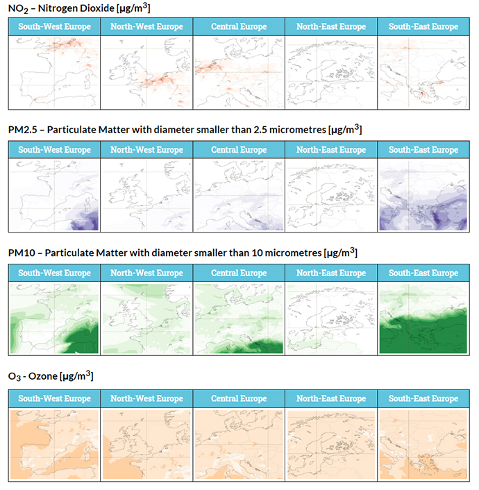
A dedicated web-based CAMS COVID resource has provided information on air quality since March, and CAMS scientists are now investigating the connection between these air quality data and COVID‑19. Maps of nitrogen dioxide, particulate matter and ozone – all known to be harmful to human health and to lower people’s immune response, making them more vulnerable to viral attacks – are released daily. Time series show changes in the levels of pollutants, and animations help to visualise air pollution. The CAMS COVID resource was developed in response to significant interest in CAMS data after the pandemic began. The aim was to make the data easily accessible to businesses, policymakers and the wider public.
These data can, for instance, be used to explore the effects of lockdown measures on air quality. In February, CAMS observed a decrease in fine particulate matter over China’s Hubei province compared to the same month in the previous three years. In midMarch, the CAMS analysis of atmospheric composition – produced by combining observations with models – showed that levels of nitrogen dioxide over northern Italy had been steadily decreasing since January. In April and May, the data showed that most European countries had lower-than-usual levels of nitrogen dioxide and slightly lower fine particulate matter levels.

Since making the COVID resource public in March, CAMS has been looking more closely into possible links between air quality and COVID‑19. The main questions that CAMS seeks to answer are whether short- and long-term exposure to air pollution are predictors for the outcome of the disease; to what extent particulate matter is involved in the spread of the disease; and what the effects of lockdown measures have been on air quality. CAMS is working with epidemiologists to investigate the first of these questions and in so doing is taking all necessary precautions around the use of personal medical data. CAMS hopes that the outcomes of these studies will help governments to implement strategies to manage possible future waves of COVID‑19 in their countries, as well as to develop some longer-term strategies if the virus is here to stay.
C3S and COVID
Meanwhile, C3S has released an application that maps COVID‑19 mortalities against temperature and humidity. It is known that other coronaviruses exhibit a strong seasonal cycle with outbreaks in winter and disappearance in the summer months. SARS‑CoV‑2 – which causes COVID‑19 – is a new virus about which we know very little. That is why C3S is exploring how it could be affected by climate.
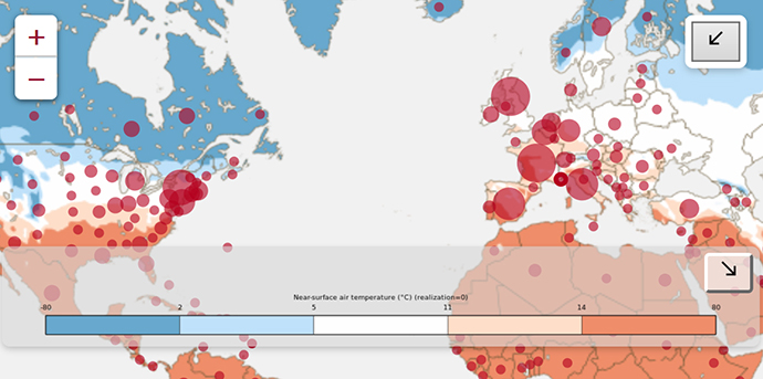
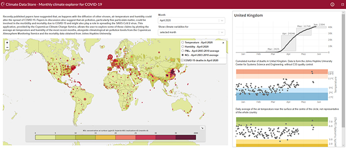
C3S developed the Monthly Climate Explorer for COVID‑19 to make climate information more accessible to policymakers and health authorities. The questions that the app could help to answer include to what extent climate controls the intensity of the outbreak; how likely a second wave is to occur upon the arrival of the next winter season; and how current outbreaks may be correlated with air pollution. It is important to note that the significant COVID‑19 outbreaks in warm Brazil and Mexico suggest that the impact of the climate on the spread of the virus is probably rather small, if it is present at all.

The first version of the app simply mapped the average temperature and humidity for each country or state against COVID‑19 deaths for each month since January. It does seem to suggest that – at least in the initial phase of the pandemic – the largest outbreaks occurred in locations averaging around 10°C. Given the possible connections between air pollution and COVID‑19 outbreaks, and taking advantage of the strong synergies that exist between C3S and CAMS, it was decided to add CAMS air quality information to the app. C3S also updated it to weight the average temperature, humidity and mortality data across each European country according to population density. This should give a better indication of the weather conditions most of the population have experienced during the outbreak. If a solid relationship between the spread of coronavirus infections and climate is confirmed, C3S forecasts of expected climate conditions for the coming months would help to provide guidance on the most suitable government interventions.

Copernicus COVID resources
CAMS COVID resource: https:// atmosphere.copernicus.eu/european-air-quality-information-support-covid-19-crisis
C3S COVID Climate Explorer: https://cds.climate.copernicus.eu/apps/c3s/app-c3s-monthly-climate-covid-19-explorer
